
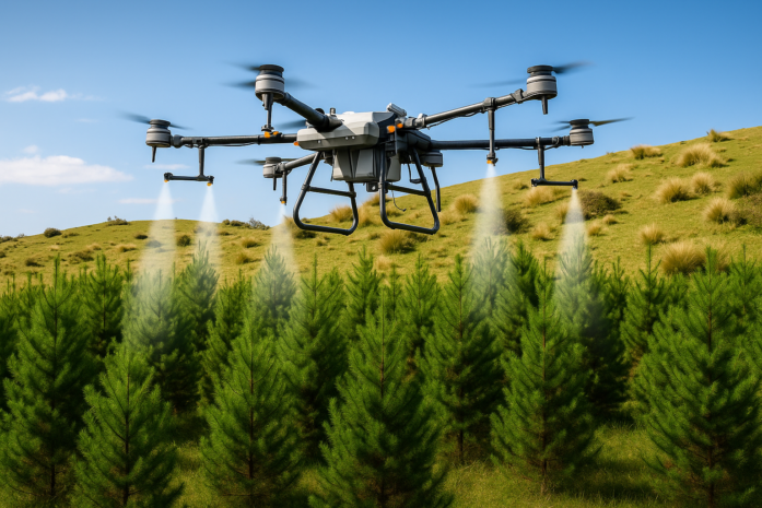
FORESTRY SPRAYING
Drones have transformed forestry management by offering a faster, safer, and more cost-effective way to collect vital environmental data and perform precision tasks. Equipped with advanced sensors like Light Detection and Ranging , thermal, and multispectral cameras, drones provide highly detailed insights into forest structure, health, and change over time.
From mapping and reforestation to wildfire monitoring and wildlife protection, drones allow forest managers to make informed, real-time decisions while reducing costs and minimizing risks to personnel.
OUR SERVICE BENEFITS
Uses of Drones in Forestry
- Forest Inventory & Mapping: Capture high-resolution 2D and 3D models for measuring tree height, canopy density, and biomass.
- Reforestation Projects: Disperse seeds and nutrients efficiently across vast or hard-to-reach areas, and monitor seedling establishment.
- Forest Health Monitoring: Detect early signs of disease, pest damage, or drought stress using thermal and multispectral imaging.
- Wildfire Management: Support early fire detection, track fire spread, and assess damage using thermal and real-time imaging.
- Wildlife Conservation: Monitor populations, track movements, and deter illegal poaching with aerial and thermal surveillance.
- Illegal Logging Surveillance: Conduct regular monitoring of remote forest regions to identify and prevent unlawful activities.
- Post-Disaster Assessment: Quickly survey and map damage from storms, floods, or wind events without endangering field crews.
- Precision Forestry & Silviculture: Assist in targeted fertilizer or herbicide application, tree thinning planning, and pruning assessments.
Advantages of Drone Use in Forestry
- Increased Efficiency: Rapidly survey large and rugged forested areas that are otherwise difficult to access.
- Improved Safety: Eliminate the need for workers to enter hazardous or unstable terrain.
- High-Quality Data: Capture fine-resolution imagery and LiDAR data that reveal detailed forest structure, even beneath dense canopy.
- Cost-Effective: Replace expensive manned aerial surveys with affordable, repeatable drone missions.
- Environmentally Friendly: Reduce habitat disturbance and soil compaction compared to ground-based machinery.
- Repeatable & Consistent Data: Program automated flight paths for long-term monitoring and change detection.
- Real-Time Information: Stream live video and data for immediate analysis during critical events like fires or storms.